Hi all
I have been attempting to build up a soil height grid using the provided sequence. It works - sort of.
The gantry moves to the correct position, it does its dance and takes a reading and pops up the notification on the web browser of what it has read for the soil height (Indicating read success) - but most of the time it is not saving the point and the reading does not appear on the GUI. So strange.
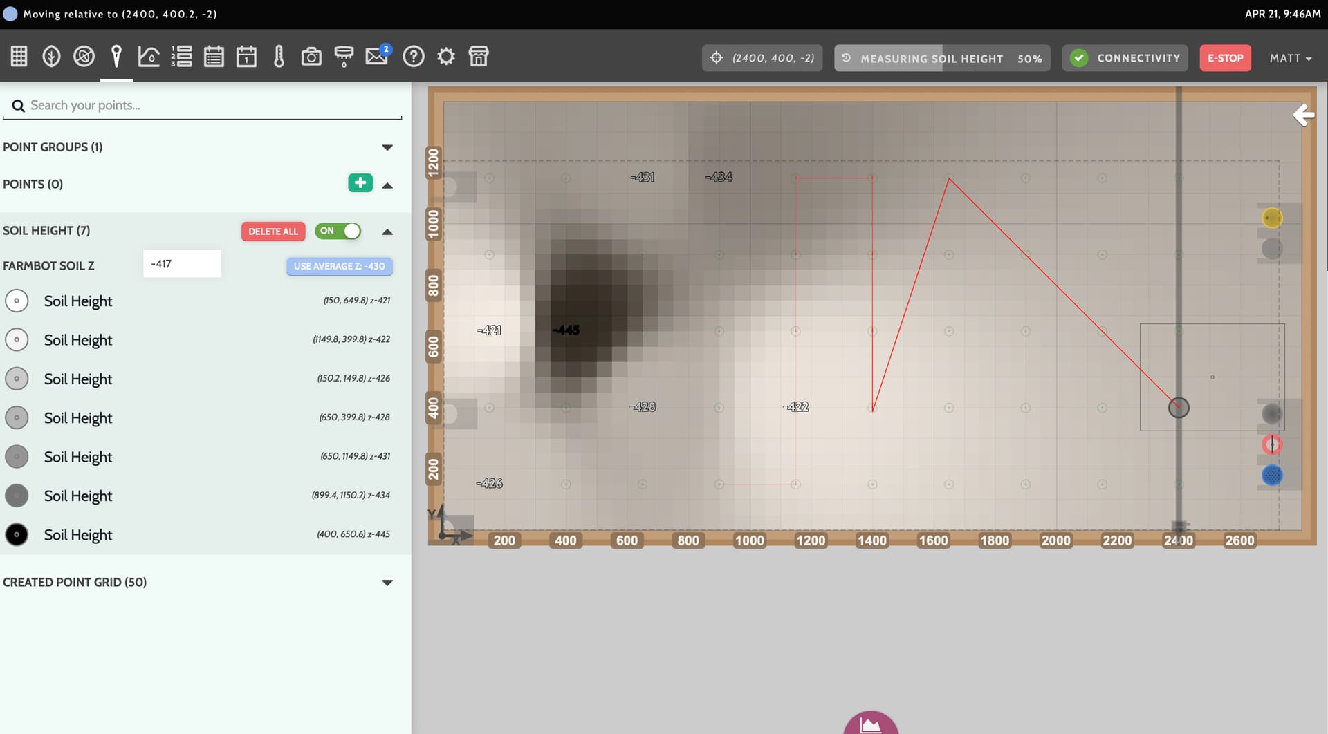
In the log files, the entries of ‘save point’ are visible but they are not getting saved.
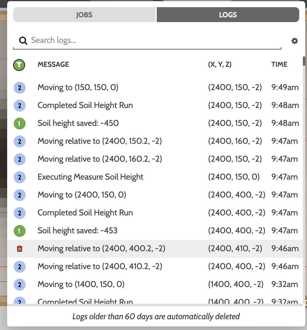
The other issue I am having is rerunning the soil grid sequence. When it is re-run, instead of going to the point and taking a new reading I am getting this kind of point recorded.
630,130 Point - First reading
630.2, 130.2. Point - Second reading
Argh! I was hoping that it would update the existing point but it does not.
The would be preferable in case the soil have been moved around.